
The vulnerability and risk assessment (VRA) conducted by the Mines and Geosciences Bureau Regional Office No. 6 (MGB RO-6) in Leganes, Iloilo warns of increased vulnerability and risk due to flood hazards.
The MGB RO-6 team who conducted the VRA from January 14 to February 5, 2016 in Leganes is composed of two geologists and a cartographer. Geologists Catherine R. Tapalla and Adeline Grace M. Torreda said that the VRA is a program of the Mines and Geosciences Bureau, Department of Environment and Natural Resources (DENR) to develop vulnerability and risk maps of cities and municipalities nationwide as a tool for a more effective physical and land use planning and disaster risk management.
In Leganes, Iloilo, flood risk data and exposure maps were developed by evaluating existing conditions of vulnerability that could potentially harm exposed elements such as people and critical infrastructures in the municipality.
MGB RO-6 Regional Director Leo Van V. Juguan said that the vulnerability and risk assessment (VRA) of areas that are highly susceptible to geohazards is considered as another milestone of MGB’s inputs for disaster reduction and management. This activity is a follow-through to the 1:10,000 scale geohazards assessment, he said.
“The VRA is a participatory process of identifying and quantifying the overall vulnerabilities of cities and municipalities to geohazards by assessing the area’s exposure to these natural hazards and the degree of their effect or impacts to a sector in a municipality or city,” explained Mae Magarzo, chief of the Geosciences Division of MGB RO-6.
Data such as administrative and barangay boundaries, land use map, population statistics, locations of houses, buildings, schools, hospital or health centers and other critical infrastructures are gathered and crucial in the assessment.
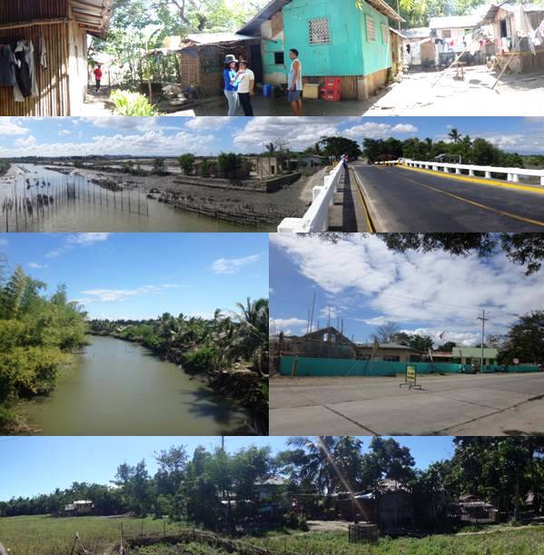
(Top photo) A resident of Sitio Sool, Brgy. Guihaman points out the flood depth at her home during Typhoon Frank. (Photos below) Areas in Barangay Nabitasan, Leganes, Iloilo that are very highly susceptible to flooding especially areas along the Jalaur River.
Updating the 1:10,000 geohazard maps of the municipality is a preliminary activity before the conduct of VRA. In Leganes, 18 barangays were assessed.
MGB RO-6 has 12 municipalities as targets for VRA in 2016. These are Leganes, Zarraga, Pavia, Barotac Nuevo, Oton, Iloilo; Laua-an, Barbaza, Patnongon, San Jose, Antique, Numancia, Aklan, Sigma, Capiz, and San Enrique, Negros Occidental.