


DENR-Mines and Geosciences Bureau Geological Database Information System
The DENR-Mines and Geosciences Bureau Geological Database Information System provides the public with information and downloadable Philippine geohazard maps. The maps can be downloaded in picture format (jpeg) Site users can download the geohazard map of...
MGB-6 gift-giving at Yolanda affected Sitio Tabong, Brgy. Atiplo, Mambusao, Capiz
MGB-6 personnel gave out family relief package to the affected residents of Sitio Tabong, Brgy. Atiplo in Mambusao, Capiz. Eighty families received the relief package containing basic necessities. Composed of 48...
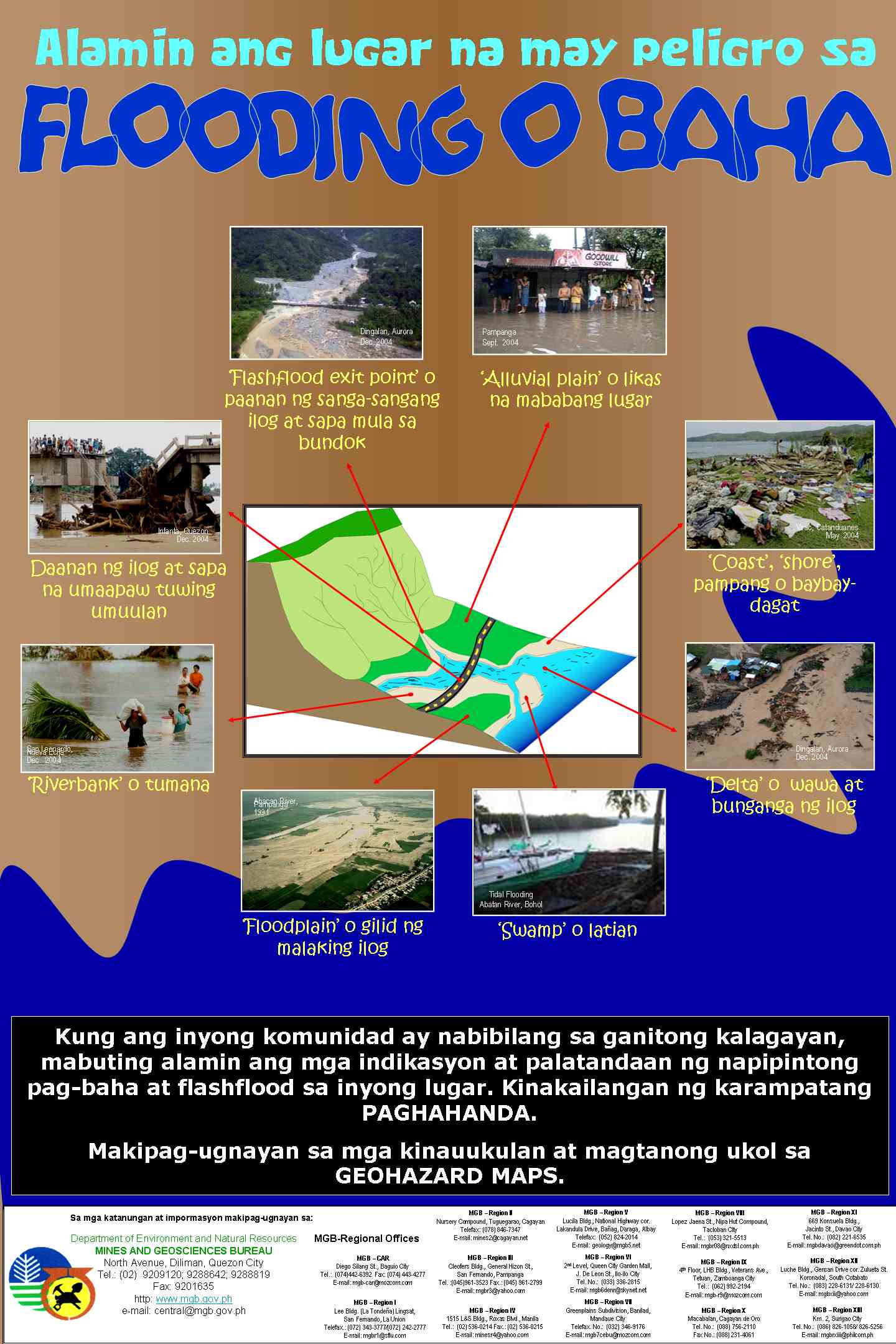
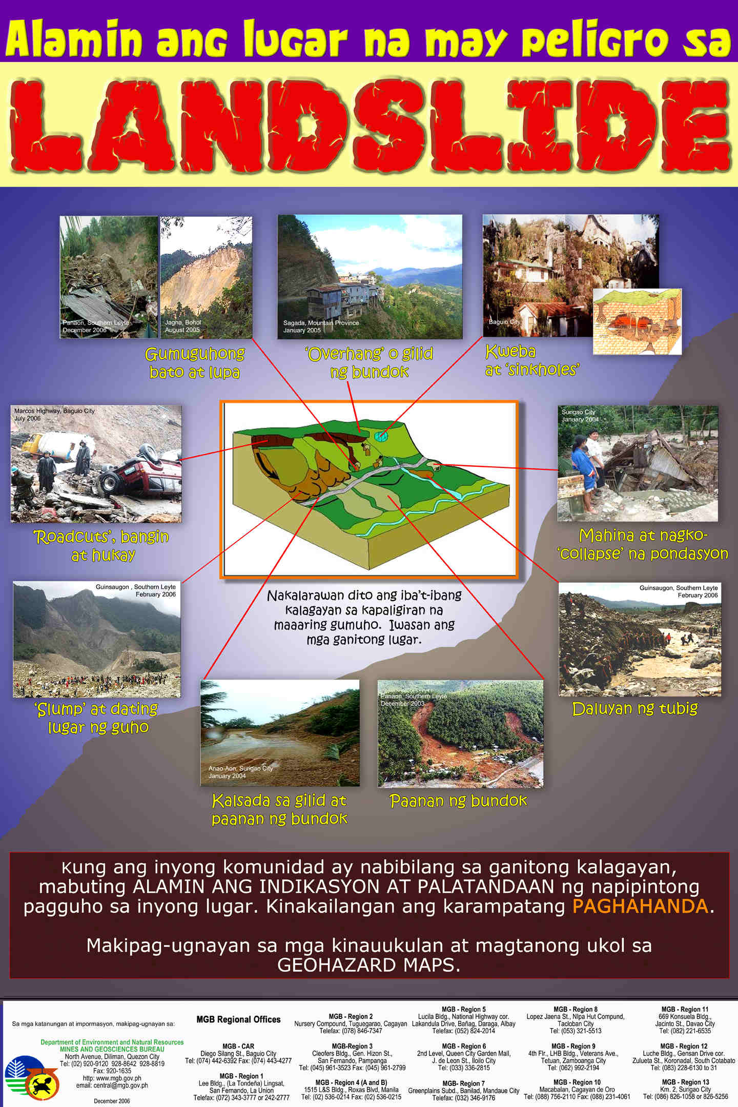
MGB geohazard maps and assessment reports – guide to risks for landslide and flood
The Geohazard Mapping and Assessment Program is a on-going priority program of the DENR, which is being implemented by the Mines and Geosciences Bureau (MGB). Its main objective is to identify areas in the country which are susceptible or vulnerable to various...
MGB-6 invites suppliers, manufacturers, suppliers to bid
DENR-MGB-6 issues geohazard advisory as typhoon Yolanda threatens Visayas region
Iloilo City – Regional Director Leo Van V. Juguan of the Mines and Geosciences Bureau Region-6 (MGB-6) issued an advisory warning local government units of possible landslides and flooding with the coming of typhoon Yolanda.Juguan advised the local government to make...
![]()
![]()

