The Mines and Geosciences Bureau VI (MGB-6), Department of Environment and Natural Resources (DENR) started a coastal geohazard mapping and assessment in specific coastal areas in the municipalities of Belison, Hamtic and San Jose, Antique this month. Adeline Grace M. Torreda, supervising geologist of MGB-6 is spearheading the activity.
The coastal geohazard mapping and assessment monitors coastal municipalities and cities to determine the occurrence of accretion and erosion taking into consideration the effects of the rising sea level due to climate change. Coastal mapping and assessment produce data as to the changes in the shorelines and if these areas are prone to erosion.
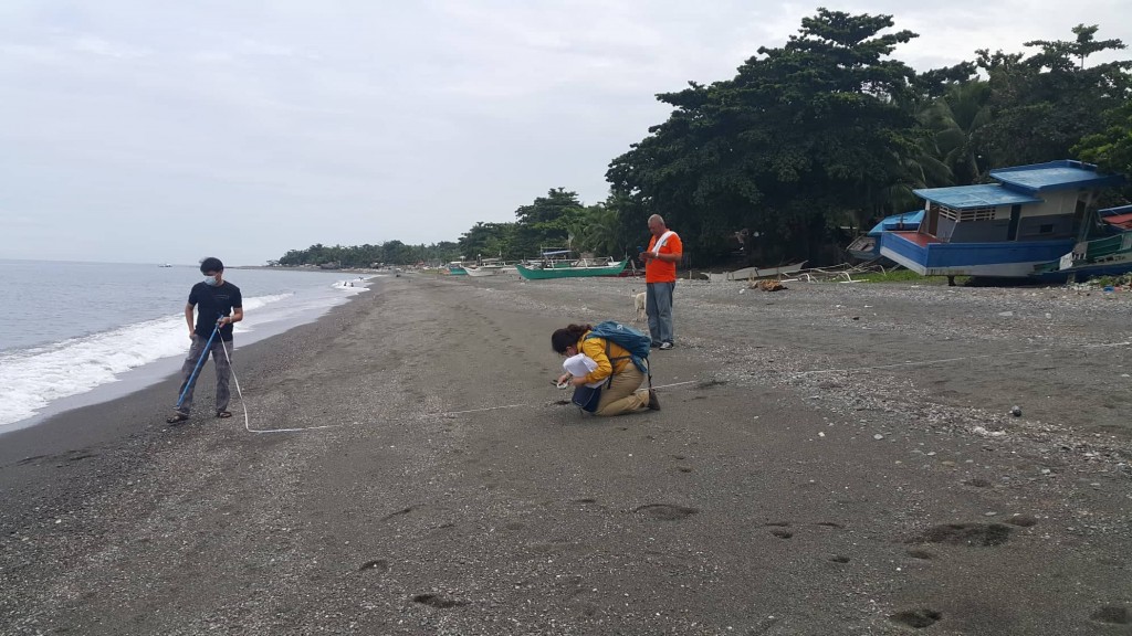
The long-term shoreline trend is gathered by comparing the newly acquired GPS data with the shoreline data from three(3) Google Earth images with a 3-to 4-yr interval. Beach profiling, shoreline mapping, analysis of the coastal area’s physical characteristics (geology, geomorphology, existing hard and soft coastal mitigating measures), and gathering of signs and erosion evidence, eroded roads and infrastructures, and anecdotal records from the coastal barangay are some of the initial activities. The team prepares a report and updates the shoreline shift maps indicating where erosion and accroccur. This activity also produces coastal vulnerability (physical) maps featuring areas most vulnerable to erosion.
MGB methodologies on coastal geohazard mapping and assessment include data integration of the results from actual field surveys, satellite images, and anecdotal interviews bearing importance on the interpretation and estimation of hazard probabilities. (MGB VI)