
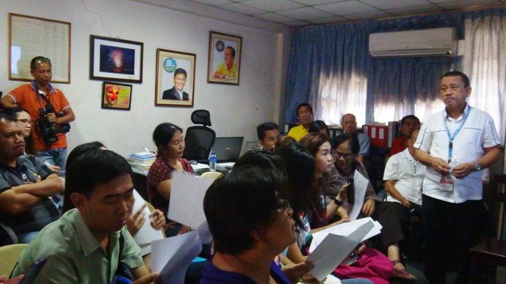
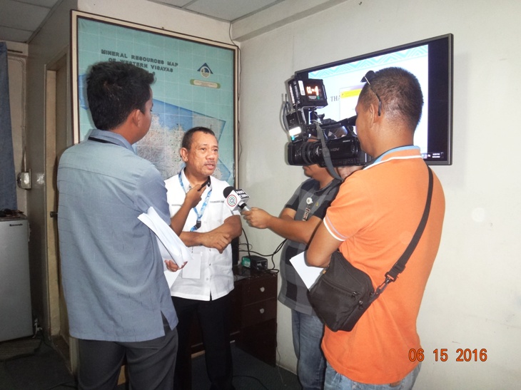
 “The rainy season is here and we are reminding the public to take extra precaution on the possible occurrence of rain-induced landslides and floods in highly susceptible areas,” says Regional Director Leo Van V. Juguan of the Mines and Geosciences Bureau, Regional Office No. 6 (MGB RO-6) during a press briefing held today at the MGB RO-6 office.
“The geohazard mapping and assessment arms us with information on what areas are at high risk for rain-induced landslides and floods. This information can help the local government units to prepare should these geologic hazards occur, RD Juguan said.
Attended by members of the print and broadcast media in the province of Iloilo, MGB RO-6 bared its priority plans and activities for 2016 that are responsive to the challenges of climate change. RD Juguan said that the MGB has been at the forefront of mapping and assessing the whole country for landslides and floods since 2005 and has completed the detailed geohazard mapping on a scale of 1:10,000 in 2014.
In the detailed geohazard mapping and assessment, the sitios of barangays were assessed on their risk for landslides and rated from low, moderate, high to very high risk using specific parameters. The same rating was done for flood susceptibility.
Based on the assessment, municipalities which have more number of barangays that have high to very high ratings for landslide risks are as follows: Balete, Buruanga, Madalag, Malinao, Nabas, Ibajay, Tangalan, Libacao, Malay and Batan province of Aklan; Valderrama, San Remigio, Laua-an, Anini-y, Tobias Fornier, Patnongon, Barbaza, Sebaste, Pandan, Hamtic and Libertad, province of Antique; Tapaz, Cuartero, Dumarao, Dumalag, Mambusao, Jamindan, Pres. Roxas, Pilar, Dao, and Sapian, province of Capiz and Leon, San Joaquin, Tubungan, Igbaras, Miagao, Lambunao, Calinog, Alimodan, Janiuay, and Concepcion, province of Iloilo.
Precaution for floods should be considered in all low lying areas for all cities and municipalities.
“We have also been conducting massive information dissemination on geohazards, giving information to the local government units such as the copies of the geohazard maps, advisories and information materials from the provincial to the barangay level. IEC with the barangays remains as one of the priorities of the MGB RO-6 this year,” RD Juguan said.
The geohazard maps can also be accessed online at the website of the Mines and Geosciences Bureau Central Office and MGB Regional Office No. 6 (www.mgb.6.org).
RD Juguan also discussed about the other programs of the MGB related to the national geohazard mapping and assessment. These are the Vulnarability Risk Assessment (VRA), Detailed Coastal Geohazard Mapping and Assessment, Karst Subsidence Hazard Assessment for sinkholes assessment and Geo-Resistivity Survey for groundwater assessment. The geohazard maps are also being updated. (MGB RO-6)